Understanding the Role of Droughts in Shaping the Earth’s Crust
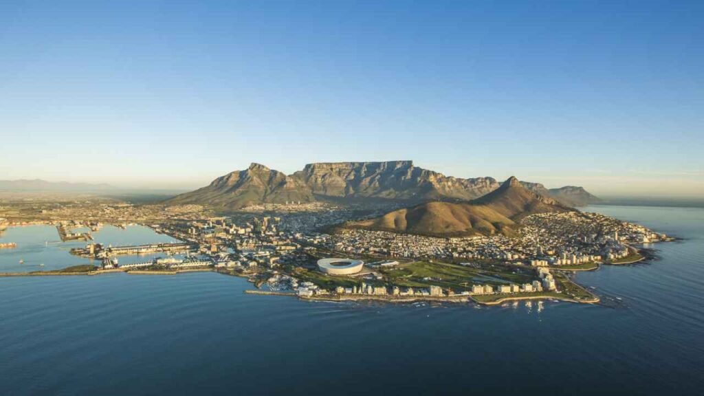
South Africa, a country renowned for its breathtaking landscapes, rich mineral deposits, and complex climate patterns, is currently experiencing a geological phenomenon that has puzzled scientists and sparked intense research: certain regions of its landmass are rising. While tectonic shifts and geological processes are the usual suspects in such cases, emerging evidence suggests that droughts may be playing a surprisingly significant role in this uplift. But how does a lack of water—a climate event—cause something as tectonically grounded as land to rise?
Why is land in South Africa rising? Droughts may have a role to play
Let’s break it down and explore this phenomenon in detail.
🌍 What Does “Land Rising” Mean?
Before diving into the causes, it’s important to understand what scientists mean when they say land is “rising.”
This vertical movement of the Earth’s surface is referred to as uplift. It can happen slowly over decades or suddenly due to natural forces like:
Tectonic activity
Post-glacial rebound
Volcanic activity
Human-induced causes such as groundwater extraction or mining
In the case of South Africa, the land uplift appears to be gradual, widespread, and correlates with periods of intense drought.
🌦️ Drought and Groundwater: The Missing Link
One of the leading explanations centers around groundwater depletion—a common consequence of prolonged drought.
Here’s how it works:
Water adds weight to the land:
When aquifers (underground water reservoirs) are full, the water exerts downward pressure on the Earth’s crust.
Drought reduces this weight:
During severe drought, reduced rainfall and increased evaporation result in less water in these aquifers.
As water drains out and is not replenished, the weight on the crust diminishes.
The crust reacts by rising:
Similar to how a mattress lifts when you get off it, the Earth’s crust responds elastically, rising slightly when the water mass is removed.
This is a process known as hydro-isostasy, and it’s gaining attention as a climate-sensitive geological effect.
📍 Evidence from Southern Africa
Research teams using satellite-based GPS measurements have detected millimeter-level vertical shifts across parts of South Africa, especially in the central and western regions, which are particularly prone to drought.
A study led by geophysicists found uplift of several millimeters per year in certain locations.
The regions showing uplift coincide with drought-affected zones, suggesting a link between climatic events and tectonic responses.
🧠 Beyond Hydrology: Other Contributing Factors
While drought-induced groundwater loss is a key player, it’s not the only mechanism responsible. Other possible contributors include:
1. Tectonic Inactivity and Crustal Memory
South Africa lies on a relatively stable tectonic plate (the African Plate), meaning there’s less frequent seismic activity. However, the crust still retains “memory” of past geological stresses. Minor stress readjustments can cause the land to flex in response to changing surface loads, such as drought.
2. Mining and Human Activity
South Africa is heavily mined for resources like gold and platinum. Extraction of underground materials can lead to land subsidence (sinking) in some regions, and rebound or uplift in others as material is removed and pressure is altered.
3. Post-Glacial Rebound (Though less relevant here)
In parts of the world like Canada and Scandinavia, the land is still rebounding from the last Ice Age. While South Africa wasn’t glaciated in the same way, far-field tectonic effects from global isostatic movements can sometimes manifest subtly in distant regions.
🧪 Implications for the Future
Understanding this vertical land movement is not just an academic exercise. It has real-world implications:
🌆 1. Urban Planning and Infrastructure
Even minor changes in land elevation can affect:
Building foundations
Roads and rail lines
Water drainage and sewage systems
🚰 2. Water Resource Management
If land uplift is tied to groundwater levels, it reinforces the urgency of sustainable water use, particularly in drought-prone areas.
📉 3. Geodetic Accuracy
Satellites and GPS systems rely on precise land measurements. Vertical shifts can cause errors in location tracking unless constantly updated.
🌱 4. Agriculture and Soil Hydrology
Changing land height—even by millimeters—can influence:
Surface water flow
Soil moisture retention
Crop planning and irrigation strategies
🔄 Is It Reversible?
Interestingly, yes—to a degree.
If a region experiences renewed rainfall, groundwater can gradually refill, restoring the weight and potentially causing the land to sink slightly again. This elasticity of the Earth’s crust is what makes the phenomenon both fascinating and unpredictable.
However, repeated cycles of depletion and recharge, especially under the strain of climate change, may cause long-term structural changes to the subsurface, making full reversibility uncertain.
🌐 The Global Context
South Africa is not alone. Similar patterns of land uplift have been reported in:
California during prolonged droughts
Australia’s Murray-Darling Basin
Parts of Spain and Turkey
This highlights a global geophysical response to localized climatic stress, reinforcing how intimately connected the Earth’s systems really are.
🧭 Conclusion
The rising land in South Africa is a compelling example of how climate change and geology intersect. While tectonic movements often get the spotlight in geological discussions, it’s becoming increasingly clear that climate-driven factors like drought can play a crucial role in shaping the Earth’s surface.
As South Africa grapples with more frequent and intense droughts due to climate change, understanding these hidden consequences will be essential—not just for scientists, but for urban planners, policymakers, farmers, and everyday citizens.
The ground beneath our feet may be more dynamic than we think—especially when the skies above stay dry.